The SS Stavronikita is not just a dive site; it is a 365-foot monument to maritime history resting upright on the seabed of the Folkestone Marine Reserve. Before it became one of the Caribbean’s most celebrated artificial reefs, it was a Greek freighter with a storied past and a dramatic end. For advanced divers, understanding its technical profile and the precision of its sinking is essential for a safe and rewarding exploration of this massive wreck, located approximately 400 yards from the shoreline of the Folkestone Marine Park.

SS Stavronikita Dive Profile & Coordinates
| Metric | Specification |
|---|---|
| GPS Coordinates | 13.136° N, 59.643° W |
| Maximum Depth (Seabed) | 130 Feet (40 Metres) |
| Minimum Depth (Masts) | 20 Feet (6 Metres) |
| Deck Depth | 80 Feet (24 Metres) |
| Vessel Length | 365 Feet |
| Date Sunk | November 21, 1978 |
The History of the SS Stavronikita: A Danish Origin
Long before it patrolled the depths of Barbados, the vessel was launched in 1956 at the Burmeister & Wain shipyard in Copenhagen, Denmark. Originally named the MV Ohio, it was designed as a robust freighter to handle demanding Atlantic trade routes. Its Danish engineering ensured a sturdy hull—a feature that remains remarkably intact today despite decades underwater and the corrosive nature of the tropical salt water. The ship transitioned through various owners before becoming the Stavronikita. After a devastating fire in 1976, it was deliberately sunk in 1978, and its structural integrity remains a testament to its mid-century Scandinavian construction.
For those interested in the broader maritime history of the island, the Museum & Marine Heritage centre provides further context on how such vessels shaped the trade routes of the West Indies. The Stavronikita represents the final era of mid-sized conventional freighters before the global shipping industry pivoted toward the massive containerisation seen today. This history is etched into the very plates of the ship, which divers can still observe near the stern sections where the original shipyard markings were once visible.
The 1976 Engine Room Disaster
The Mid-Atlantic Crisis
In 1976, while the Stavronikita was in transit from Ireland to the Caribbean, a catastrophic fire erupted within the engine room. The blaze was uncontrollable, stripping the vessel of all propulsion and electrical power. This left the 365-foot freighter drifting aimlessly in the Atlantic for four days. The crew faced a dire situation until the ship was eventually spotted and towed into the Bridgetown Port, where it sat derelict for two years while its fate was debated by local authorities and salvage experts.
The 101,000-Bag Cargo
The ship’s cargo holds were filled with 101,000 bags of cement, a payload that would ultimately define its sinking. Following the fire and during the four days the ship spent adrift, the water used to fight the blaze caused much of the cement to hydrate and harden. This massive, solidified weight acted as permanent ballast, significantly complicating salvage efforts but providing the ship with incredible stability. It is this weight that keeps the wreck from shifting even during the most severe Atlantic swells that occasionally impact the Barbados West Coast.
Precision Sinking: The US Navy EOD Operation
The transformation of a derelict freighter into a world-class artificial reef was not a matter of chance. On November 22, 1978, the Barbados government collaborated with the U.S. Navy’s Explosive Ordnance Disposal (EOD) team to execute a controlled scuttling. This was a tactical operation designed to place the ship precisely within the boundaries of what would become the Folkestone Marine Reserve. To ensure the ship remained a safe attraction for decades, the masts—which originally reached within 15 feet of the surface—were cut down to 20–25 feet to prevent them from becoming a hazard to deep-draft vessels navigating Zone A.
“Seven strategically placed shaped charges were detonated by the US Navy EOD team to ensure the Stavronikita settled perfectly upright on the sandy floor, preventing a capsize that would have ruined the site’s diveability.”
The precision of the EOD team’s work is evident today. The ship rests with its bow pointing North/Northwest, a heading that allows the prevailing south-to-north current to flow naturally across the hull. This orientation is a significant aid for underwater navigation, allowing divers to use the ship’s own axis as a compass. If you are planning your journey to the park to see this site from the surface or prepare for a boat departure, consult our transportation guide for the best routes to the Holetown docks.

Resting Profile: Orientation and Light
The ship sits generally upright on the sandy seabed, a position that creates unique opportunities for underwater photographers. During morning dives, the solar penetration hits the starboard side of the deck and the bridge, illuminating the thick growth of sponges. In the afternoon, the light shifts to reveal the deep recesses of the port-side companionways. For those not diving, the beaches nearby offer a view of the buoy markers where the ship rests, giving a sense of its proximity to the shore.
Marine Flora: Gorgonians and Black Coral
The Stavronikita has become a vertical forest of marine life. It is particularly renowned among macro-photographers for its dense colonization of Gorgonians (sea fans) that cling to the ship’s railings. However, the true biological treasure is the rare deep-water Black Coral (Antipathes). These delicate, branch-like structures are found primarily along the railings of the stern at depths exceeding 90 feet. Because of the delicate nature of these organisms, divers must maintain excellent buoyancy control to avoid damaging decades of growth.
The environment around the wreck is also influenced by the “Holetown Hole,” a nearby drainage area. After heavy rainfall, visibility can drop from its usual 100-foot range to 60 feet or less due to sediment runoff. Divers should always check the local conditions and safety protocols outlined in our Barbados Snorkeling Safety guide, as the currents on the wreck can vary from a mild drift to a moderate surge that requires significant effort to swim against.
Penetration Routes: Forward and Aft Cargo Holds
For those with Advanced Open Water or Wreck Diver certification, the Stavronikita offers massive cargo holds to explore. The forward and aft holds are the most popular choices for penetration. These spaces are cavernous and benefit from significant ambient light that filters through the large, open hatch squares. Inside, the walls are heavily encrusted with deep-water sea fans and sponges, while a fine layer of silt covers the floor. The remnants of the 100,000 bags of cement have long since hardened, appearing now as coral-covered mounds that have merged seamlessly with the ship’s structure.
Wreck Site Location
Stavronikita Dive FAQ
- What certification level is required for this dive? Because the seabed rests at 120 feet and the main deck is at 80 feet, an Advanced Open Water certification is strictly recommended to manage the depth and potential nitrogen narcosis. Open Water divers may visit the upper masts, but they will miss the majority of the ship’s features.
- Are there specific hazards divers should be aware of? Beyond the depth, the wreck features sharp, rusted metal and stinging hydroids that have colonised the railings. Divers should also be cautious of the south-to-north current, which can pick up unexpectedly and make the return to the mooring line difficult.
- When is the best time of year to dive the Stavronikita? The West Coast of Barbados offers the calmest seas between January and May. During the summer months, while the water is warmer, occasional swells from distant Atlantic weather systems can reduce visibility and make boat entries more challenging.
- Can I see the wreck while snorkeling? While the masts were cut down to 20 feet, they are still too deep for most casual snorkelers to see clearly from the surface. Snorkelers are better served visiting the shallow snorkel trail and the smaller barge located closer to the Folkestone beach.
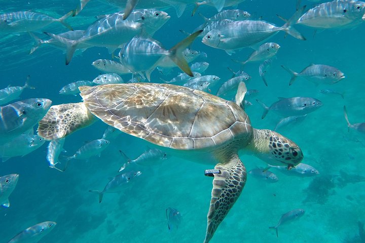
- What marine life is commonly spotted on the wreck? In addition to the corals, divers frequently encounter large barracudas that use the masts as hunting grounds. Schools of horse-eye jacks often circle the mid-section, and the occasional hawksbill turtle can be seen resting on the deck plates.
Planning to tackle the depths of the Stavronikita? Ensure your logistics are settled by checking our guide on planning your visit to the Folkestone Marine Park.

Barbados Turtle and Shipwreck Snorkel Adventure
Join us aboard Tranquility Cruises a Snorkel Boat for our 90 minutes turtle & shipwreck adventure. The cruise departs from our. Dock in the Careenage in Brid…

Folkestone Coral Reef Clear Kayak Tour
Take in some of the most picturesque shoreline on the west coast of Barbados as we set off from Surfside beach and head to Folkstone Marine Park. Here you wi…
Barbados Shore Excursion Snorkel cruise and Beach Day
Hop on our shuttle to Savvy on the Bay and board our vessel Tranquility with ease and join us on our 1.5 hour Turtle & Shipwreck adventure in Carlisle Bay. …

Barbados Coastal Tour
Embark on a scenic tour of the entire island of Barbados and its magnificent coast, including the island’s first capital and UNESCO World Heritage-Listed Bri…

Barbados Private Customised Island Tours
You will have a blast of a time. Travelers will have the opportunity to plan their personal itinerary with the assistance of a courteous, honest, friendly an…

Barbados Full-day Private Tour
Ride in comfort while exploring rural Barbados with a courteous, honest, friendly and well informed driver/guide. On this Barbados Full Day Private Tour, tra…